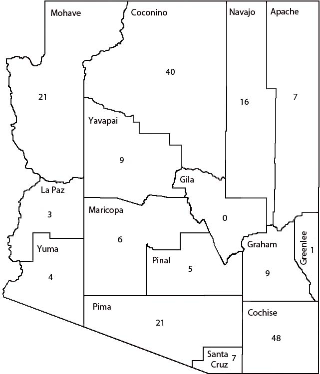
General Description. Map of Arizona showing counties. Numbers indicate the number of Pleistocene sites per county as of this date (includes as single sites related sites treated as single faunas; e.g., 111 Ranch). As can easily be seen, sites are concentrated in southern, and especially southeastern, Arizona and in the northwestern quadrant. Contributing strongly to the southern region are late Wisconsin open sites along drainageways, though several caves are responsible for the majority of taxa from the region. Cave deposits and woodrat middens are largely responsible for the number of sites and taxa in the northwestern part of the state.
Last Update: 27 Mar 2013